Though Hampton Roads is not expected to be hit by Humberto, which strengthened to a hurricane overnight Friday, the region will still feel its effects next week with strong winds, heavy rainfall and risks of flooding.
Humberto has been creeping northward from Puerto Rico toward the East Coast in recent days and is now a Category 4 storm with maximum sustained winds topping 145 mph, according to Mike Dutter, Science Operations Officer for the National Weather Service in Wakefield. Dutter said during a Saturday morning advisory the storm is still ragged and has recently settled, and newest tracks keep the storm away from Virginia.
“The good news, at least for local areas, is that the storm is expected to stay well offshore,” Dutter said.
But Humberto isn’t the only storm the weather service is tracking.
Tropical Depression 9, hovering over Cuba, is expected to become Tropical Storm Imelda later Saturday. The storm is forecast to slowly move northward over the Bahamas for the next few days, but the projections become uncertain past Tuesday.
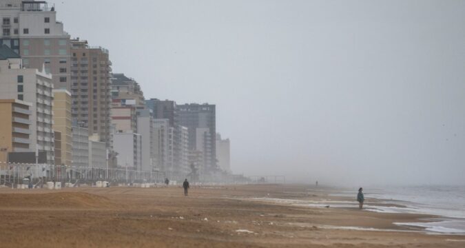
Hampton Roads and northern North Carolina are expected to see up to between 3 and 5 inches of rain through Monday morning, with the largest downfalls forecast later Saturday and Tuesday, according to the NWS.
There is an up to 40% chance areas in Richmond and Newport News could see more than 4 inches of rain, which could lead to flash flooding. However, all of Hampton Roads will have a marginal risk of isolated flash floods through Monday, and a slight risk of excessive rainfall through Tuesday. According to Dutter, some of those estimates are dependent on whether Imelda stays farther south and remains offshore, or moves north toward Virginia.
“If the storm does move slightly further north, this could edge further northward, the heaviest rain,” Dutter said. “If it stays offshore and stays south, the heaviest rain will stay out of the area. So, there’s still a lot to be determined for the middle to the end of next week.”
Dutter added there is no coastal flooding expected through early Tuesday, but water levels will increase Tuesday with potential for northeast winds to create significant tidal flooding through the rest of the week.
Rip current risks will remain low through Sunday, but will increase with waves early next week. Dutter said Virginia’s beaches will likely frequent waves topping at 7 feet by Tuesday, and could see waves reaching 10 feet by Wednesday.
Devlin Epding, 757-510-4037, devlin.epding@virginiamedia.com
https://www.dailypress.com/2025/09/27/humberto-tropics-forecast-hampton-roads/

