The American Battlefield Trust is trying to preserve two more Civil War battlefield properties that are connected to the May 5, 1862, Battle of Williamsburg.
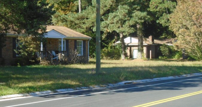
A 2.2-acre site containing two abandoned homes, located in what is called the triangle parcel, is located about a quarter-mile in front of the existing Fort Magruder in York County. The land is adjacent to property already owned by the trust and is available for purchase along with 21.79 acres along Pocahontas Trail (Route 60) near the boundary between James City County and Williamsburg.
“Valued at $3.68 million, these properties are considered part of the corps area of the battlefield,” said Jared Herr, a spokesman for the trust. “We consider that these lands are a very important part of the battle story and are key preservation areas for us.”
The trust is actively seeking funds from national donors that hopefully can be combined with state and federal preservation money to enable the purchases. Two other Virginia battlefield lands from the First Manassas (Bull Run) and Second Manassas (Bull Run) battlefields are included with the Williamsburg parcels with a total value of $5.2 million. The American Battlefield Trust needs $155,295 to reach its financial goal.
A brochure urging money for the Virginia purchases stresses that a $50 donation equals $1,700, while a $100 donation would equal $3,400 in needed funds.
Along with land along Penniman Road, the American Battlefield Trust is hoping to purchase 21.79 acres along Pocahontas Trail (Route 60) near the boundary between James City County and Williamsburg. (Wilford Kale/For The Virginia Gazette)
The Williamsburg battle, part of the Peninsula campaign, occurred when the advance troops of Union Gen. George B. McClellan caught up with the forces of Confederate Gen. Joseph E. Johnston that were retreating from Yorktown to avoid a siege.
The 22 acres are called the Knox Tract because Union Capt. John J. Knox of the 5th Michigan Volunteer Infantry wrote a letter after the battle describing action on the site.
The Michigan unit fought under Maj. Gen. Philip Kearny over land where Confederates held the trenches on the north rim of the “bloody ravine.”
This map shows the May 5, 1862, Battle of Williamsburg. The light-blue shaded areas are areas that have been preserved by the American Battlefield Trust. The yellow-shaded areas are those the trust hopes to purchase. Gray-shaded areas are preserved by Colonial National Historical Park. The red and blue lines represent Confederate and Union troop movements. (American Battlefield Trust)
Carson O. Hudson, a local authority on the Battle of Williamsburg, explained that the ravine action was in the morning of the battle. The Union forces and Confederates exchanged attacks with “shooting over the ravine and on its slopes,” he said.
Across the battlefield near Fort Magruder, the headquarters of the Confederate defensive line about 2 miles east of Williamsburg, the 4th Virginia Cavalry was ordered to “proceed cautiously down Telegraph Road and reconnoiter the position and movements of the enemy” at a Union artillery site on the triangle parcel. The cavalry ran into some infantry under Brig. Gen. Winfield S. Hancock and fighting began on that portion of the battlefield, according to Carol Kettenburg Dubbs in her book, “Defend This Old Town: Williamsburg During the Civil War.”
Today, “instead of houses we can add to property we already own,” Herr said, “and the land can be appropriately interpreted as a park.” The area is zoned for development of single-family residential homes, while the Knox Tract is available for commercial development with many feet of valuable road frontage on Pocahontas Trail.
Over the recent decade the trust has saved about 343 acres of the vast Williamsburg battlefield, extended nearly from the James to the York rivers.
Wilford Kale, kalehouse@aol.com

