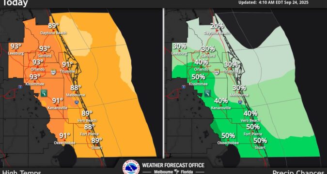
Central Florida’s chances for rain have increased on Wednesday as temperatures on the interior climb into the low 90s, according to the National Weather Service.
Because of swells from distant Hurricane Gabrielle in the Atlantic, the east coast beaches are also seeing a high risk for life-threatening rip currents through mid-week.
Deeper moisture is settling over the region increasing chances for scattered shower and lightning storms. The NWS in Melbourne says the biggest chances of 40-50% will be farther south including metro Orlando. Some areas could get 2 inches of rain.
“Primary lightning storm impacts remain occasional to frequent lightning strikes, gusty winds locally up to 45-55 mph in strongest storms, small hail, and locally heavy downpours which could induce minor/nuisance flooding. Localized amounts of 1-3 inches in a short period of time will be possible with a couple 4 inch totals not out of the question,” forecasters said.
Temperatures are slightly above normal or the interior through Friday reaching into the lower 90s each afternoon. Wednesday’s heat indices are forecast to hit feels-like temperatures between 98-105 degrees Fahrenheit.