Wintry precipitation remains a near-certainty for the Lehigh Valley region after Christmas, but how much snow and ice will fall remains in flux, according to forecasters.
The region had been under a winter storm watch for Friday afternoon through Saturday morning, but that has been downgraded to a winter weather advisory. The National Weather Service now says the region can expect total snow and sleet accumulations of 1-3 inches, with a light glaze possible. Those amounts are down from earlier forecasts, which were in the 4-6 inch range.
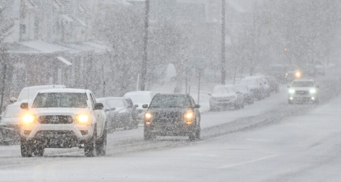
The latest snowfall projections from the National Weather Service’s Mount Holly, N.J., forecast office.
The weather service’s snowfall projection map issued Thursday morning showed most of Lehigh and Northampton counties getting between 1 and 4 inches of snow, with a small sliver of northeastern Northampton County getting between 2 and 6 inches.
In its forecast discussion Thursday morning, the weather service’s Mount Holly, N.J., office said the latest trend shows the storm moving slightly to the north, which could lead to more sleet mixing in with snow, and decreasing the chance for freezing rain.
However, don’t let that bit of positive news fool you: The snow and sleet we do get will be more than enough to make a mess.
“There remains high uncertainty how much and where the sleet/snow mix will end up panning out for the region, but the main takeaway here is that we continue to expect a wintry mess for much of the region Friday afternoon through Saturday morning,” forecasters noted.
The shift in storm track means that areas north and east of the Pocono Plateau will see nearly all snow, with total amounts of 3-6 inches. However, some localized areas could see heavier snow falling at a rate of more than an inch per hour, leading to even higher accumulations, according to the forecast discussion.
However, for the Lehigh Valley and areas to the south, projected snow and sleet amounts are anything but a sure bet. The latest models are showing some warm air mixing in, favoring sleet and cutting into snowfall totals, forecasters said.
“Long story short, despite the high uncertainty with the final snow and sleet totals, disruptions are to be expected Friday afternoon and Friday night as this system moves through,” according to the forecast discussion. “Periods of snow, sleet, and/or freezing rain/ice will make travel dangerous and anyone with travel plans will see disruptions.”
The weather service continues to urge anyone who was thinking about traveling Friday afternoon through Saturday morning to delay those plans. Anyone who must drive should consider taking a winter storm kit with items such as flashlights, shovels, blankets, extra clothing “and anything else that would help you survive in case you become stranded,” the weather service warned.
Ahead of the storm, PennDOT worked to treat roads to help prevent ice buildup once the wintry precipitation begins. It also issued restrictions on some tractor-trailers and other vehicles on highways across eastern Pennsylvania during the storm.
As for timing, the weather service’s forecast for the Lehigh Valley shows snow starting by 4 p.m. Friday, later than initially expected, and continuing through the late evening hours. Before midnight, sleet is likely to begin mixing in and continue through early Saturday morning.
The precipitation could turn back to all snow before tapering off mid-morning, though snow showers are still possible, particularly in northern areas, according to the forecast.
Expect a brief break in precipitation from Saturday afternoon through Sunday morning before a frontal system moves in by Sunday afternoon. However, warmer temperatures mean any precipitation that falls is expected to be all rain in the Lehigh Valley, though a wintry mix is possible in parts of the Poconos and northwestern New Jersey, forecasters said.
The rain is expected to continue through Monday afternoon before things clear out. Behind the front, high pressure and colder temperatures will move in, with daytime highs in the low 30s, well below normal for this time of year, according to the forecast discussion.
Here is the extended forecast from the National Weather Service:
Friday: Snow likely, mainly after 5 p.m. Mostly cloudy, with a high near 29. North wind around 5 mph becoming southeast in the afternoon. Chance of precipitation is 60%. New snow accumulation of less than one inch possible.
Friday Night: Snow and sleet before 1 a.m., then snow likely, possibly mixed with freezing rain and sleet. Low around 23. Southeast wind around 5 mph becoming northeast after midnight. Chance of precipitation is 100%. Little or no ice accumulation expected. New snow and sleet accumulation of 1 to 3 inches possible.
Saturday: A chance of snow, freezing rain, and sleet before 7 a.m., then a chance of snow and freezing rain between 7am and 1pm. Cloudy, with a high near 34. Northeast wind around 5 mph. Chance of precipitation is 30%. New snow and sleet accumulation of less than a half inch possible.
Saturday Night: Mostly cloudy, with a low around 21. Calm wind.
Sunday: A chance of rain after 1 p.m. Mostly cloudy, with a high near 37. Chance of precipitation is 40%. New precipitation amounts of less than a tenth of an inch possible.
Sunday Night: Rain. Low around 32. Chance of precipitation is 80%.
Monday: Rain, mainly before 1 p.m. High near 48. Chance of precipitation is 80%.
Monday Night: Mostly cloudy, with a low around 24. Breezy.
Tuesday: Mostly cloudy, with a high near 31. Breezy.
Tuesday Night: Mostly cloudy, with a low around 22.
Wednesday: Partly sunny, with a high near 35.
https://www.mcall.com/2025/12/25/allentown-weather-winter-storm-update-snow-totals-change/

